51.132519816263, 1.3464675843716
Wessex Archaeology has been commissioned by English Heritage to carry out a Rapid Coastal Zone Assessment Survey of South East England. The aims are to enhance the archaeological records of the National Monuments Record, local Historic Environment Records and Sites and Monuments Records, and to serve as a basis for improved management of the coastal historic environment.
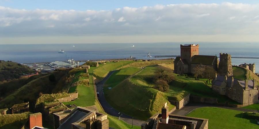
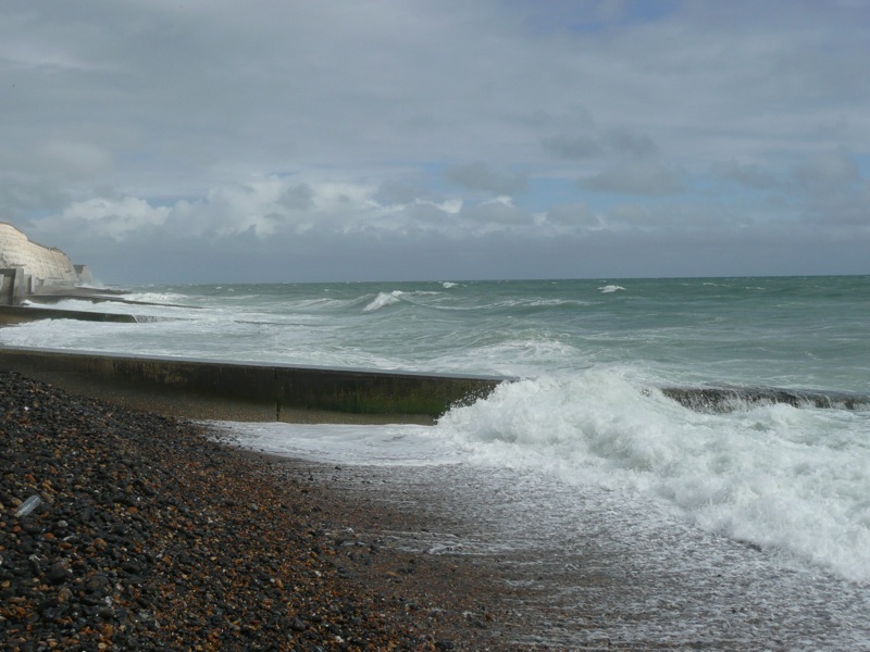
The historic environment of South East England's coastal zone is rich and diverse, and it illustrates the long and complex relationship between people and the sea. The coastal zone includes not only terrestrial sites such as cliff top inhabitation sites or, in the low lying areas, evidence of salt-making activities, but also maritime material, such as shipwrecks, harbour installations and fishing weirs. In the intertidal and sub-tidal zones, there is also evidence of human occupation when sea levels were lower and areas that are now submerged were dry land and habitable. From the 500,000 year old human remains at Boxgrove to the intense military activity in and over the Straits of Dover in WWII, it is unlikely that any period or theme in coastal archaeology is not represented on the south east coast.
The historic environment is fragile and irreplaceable, and it is under threat from pressures such as commercial development and the processes of coastal change linked to sea-level rise and climate change. In order to identify the effects of these threats, it is essential that the extent and nature of the historic environment resource is more clearly defined and understood. Therefore, Rapid Coastal Zone Assessment Surveys (RCZAS) have been undertaken, or are in the process of being undertaken, around the coast of the UK, with the South East one of the last regions to be studied. These RCZAS are part of a wider English Heritage initiative, and it is expected that the archaeological survey of the entire English coast will be completed by 2013. The RCZAS will feed into the second stage of Shoreline and Estuary Management Plans (SMPs), providing vital information for future development and coastal management decisions.
The RCZAS of South East England comprises of two phases. Phase 1, which has just commenced, consists of a desk-based assessment and includes analysis of aerial photographs as part of the National Mapping Programme (NMP). In Phase 2, field survey, informed by the results of Phase 1, will verify and assess known sites and will aim to detect previously unknown or unrecorded sites on the ground.
The study area for the RCZAS of South East England extends from Redbridge in Totton, Hampshire to White Ness in Kingsgate, Kent. For the NMP the survey will analyse aerial photographs along the coast, in 1km squares covering either side of high and low water. Aerial photographs will also be examined for the low-lying river valleys that have not yet been covered by previous NMP projects. The desk-based assessment will extend inland 1km or to the +5m contour, whichever is furthest, in order to cover areas of low-lying coastal land, and will extend offshore six nautical miles, which represents the limit of local-authority based Sea Fisheries Committees. Information gathered from a wide variety of sources will be integrated with the existing historic environment records and analysis of aerial photographs to identify known archaeological remains in the coastal zone and to illustrate areas of likely archaeological potential. Archaeological potential will also be identified through an overview of past coastal change from the Late Upper Palaeolithic to the present. Once this research has been completed, the importance and vulnerability of all stretches of coast will be assessed. Models of future coastal change will be examined in order to assess the overall degree and nature of threat to coastal historic assets, and areas or sites at risk of damage or destruction due to coastal change will be identified. The results of the study will provide a sound basis for developing management priorities, including the identification of areas or sites meriting further survey or evaluation, positive management action, or possibly statutory protection.

To ensure that the survey meets the requirements of local curators, a Liaison Group has been established, with representatives of English Heritage, the Environment Agency, and the National Trust, as well as the local authority archaeologists responsible for Hampshire, East Sussex, West Sussex, Kent, Southampton, Portsmouth, Chichester and the New Forest National Park Authority.